What is the DART network
Bernabe Gomez
The DART (Deep-ocean Assessment and Reporting of Tsunamis) network is a system of buoys and sensors designed to monitor and detect tsunamis in the deep ocean. You can find more information about the DART network here: DART Wesite
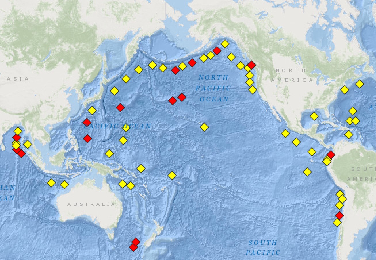
In the National Data Buoy Center (NDBC) portal you can find all the deployed DART buoys locations and periods of operation times. Water level time series are provided and can be downloaded. As a first step you can choose the station that you are interested in.

Map of the DART buoy locations
Download and visualize the tsunami
In this lesson we are downloading some water level time series associated with the Tohoku earthquake of 2011. Tohoku tsunami.
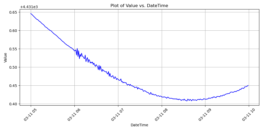
For that purpose we will choose the station: "Station 46404 - WEST ASTORIA", which is in near proximity of the earthquake epicentre. The target earthquake happened on the 11 March 2011, at 14:46 JST (05:46 UTC), a Mw 9.0 to 9.1 Tohoku earthquake. Tohoku earthquake. The recorded data is provided in either heights (wave heights, with a sampling period of 45 minutes) or wave events where the sampling period is 1 minute.
The format of the data downloaded is #YY MM DD hh mm ss T HEIGHT, so we have to process it accordingly.

Extracted water level time series associated with the analysed tsunami event
You can find the Jypyter notebook code associated with this lesson here: Follow this Link.